
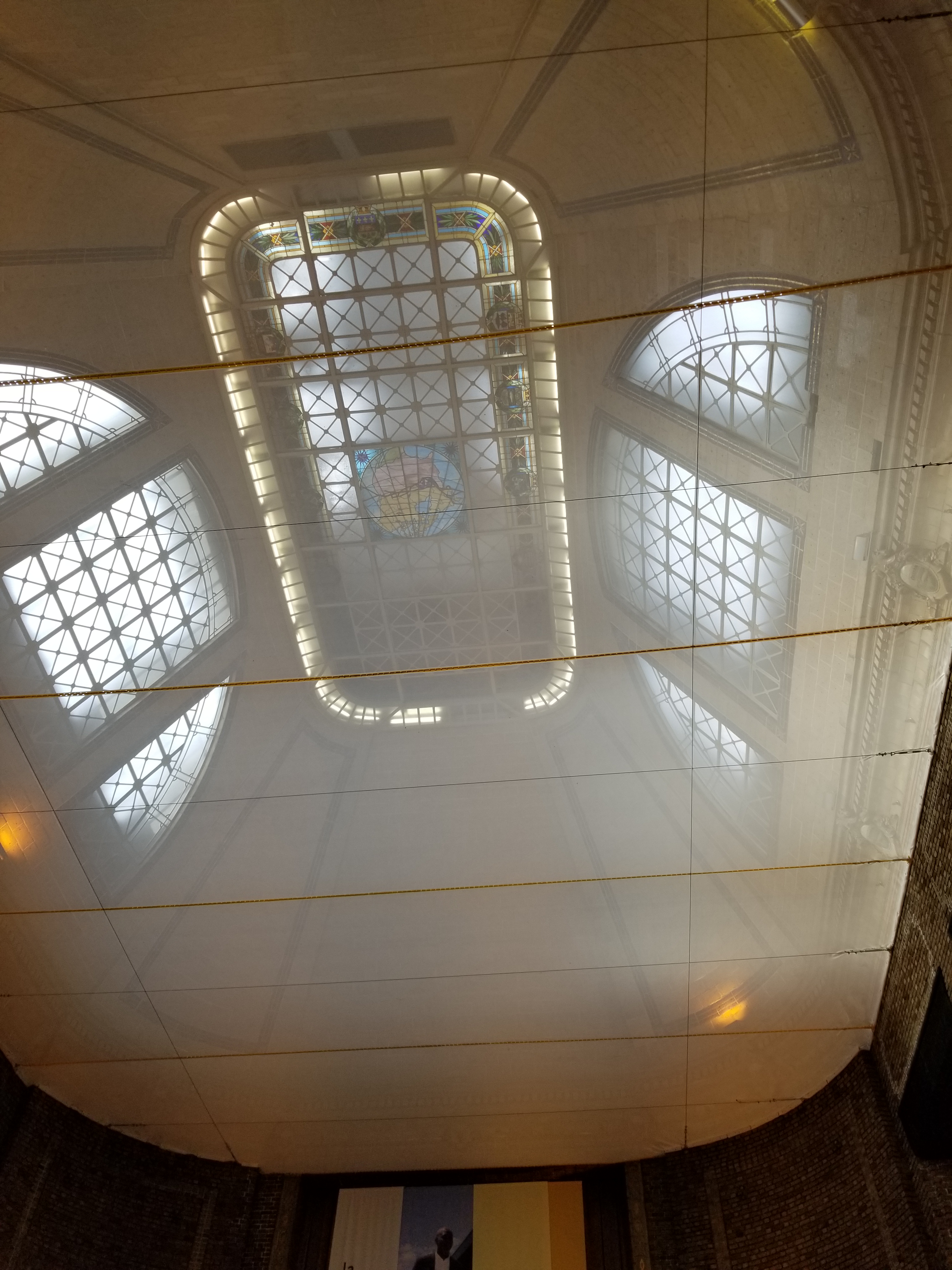
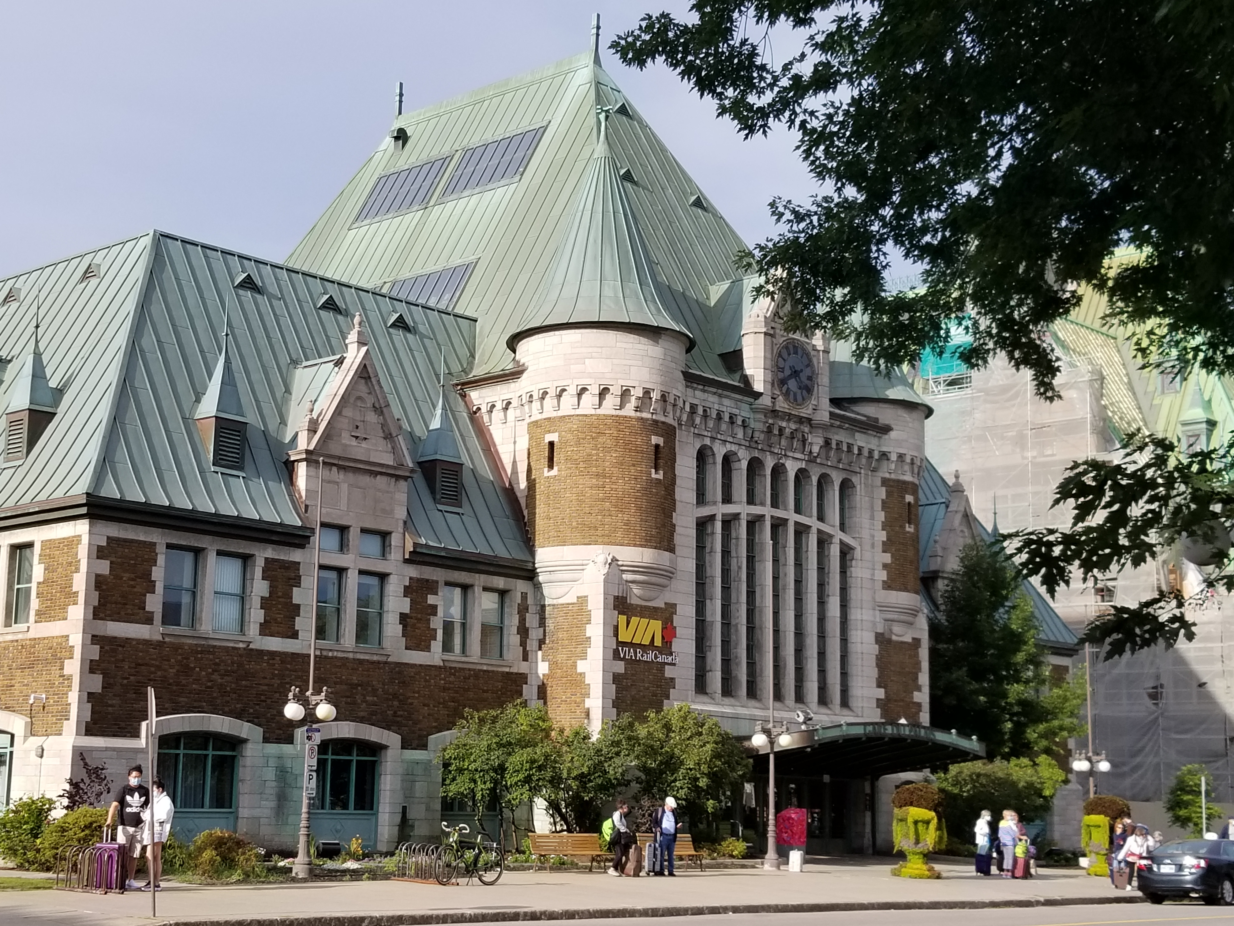
I felt like a time-traveller within ten minutes of arriving in Quebec City by train. The stairs up from the platform led into a resplendent bricked hall with caged windows that looked like something from Queen Victoria’s time. A domed sunlit ceiling of glass and stained glass made the space luxurious and opulent.
A conference presentation brought me to Quebec City, but I also wanted to use the trip to learn more about ten ancestors who once lived there. I wanted to to see if I could get a better sense of my ancestors’ lives by walking in their footsteps even though the city in which they once lived has changed enormously over the ages. If studying history helps us recognize patterns about our lives that are invisible in close context, perhaps I could use my five senses to imagine the lives of people who lived in this Canadian City in previous eras and use the insight gained to learn something needed now.
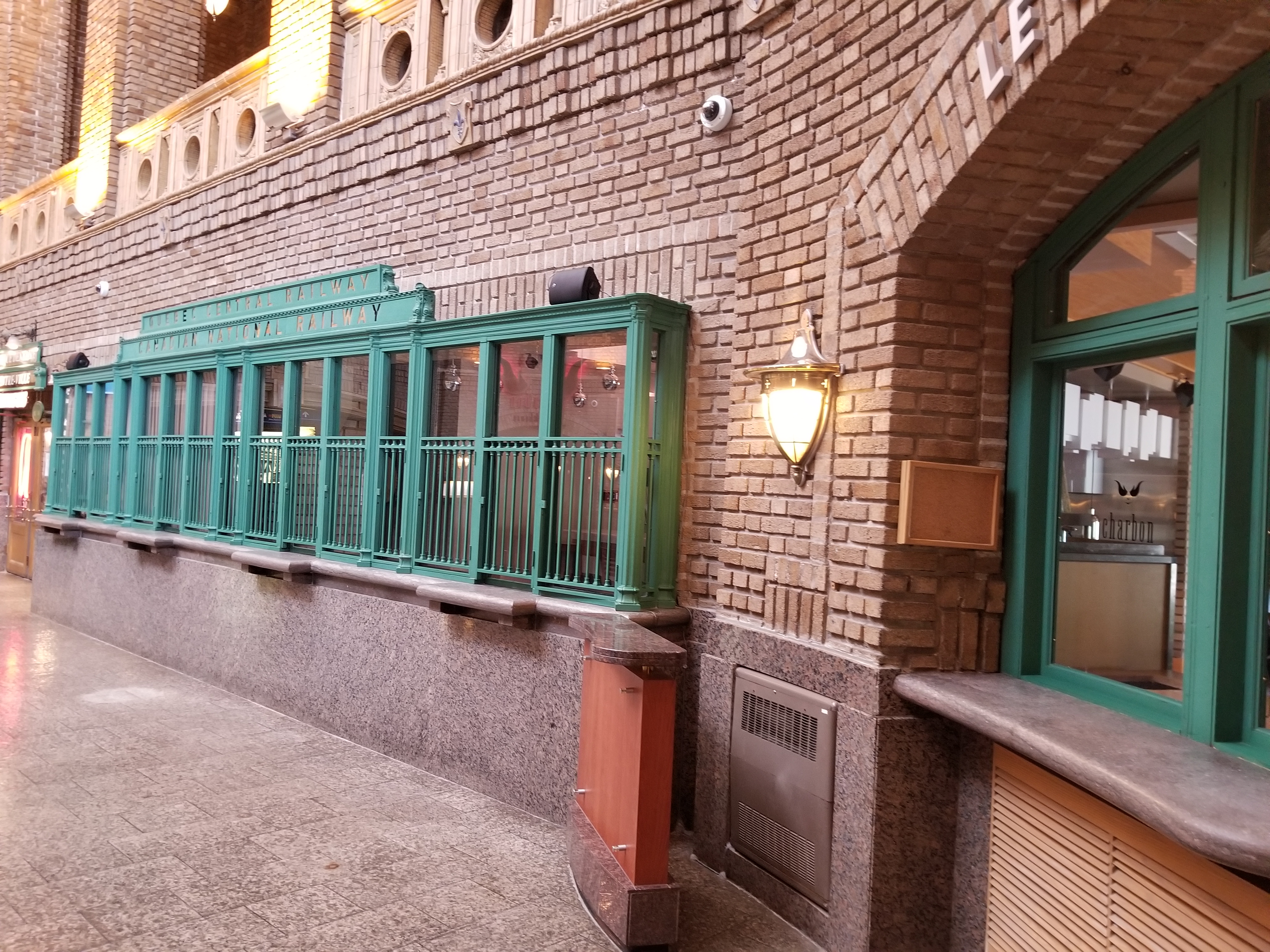
As far as I know, my ancestors had long left Quebec City by the time the train station opened, so beginning my trip in this building didn’t have any personal relevance, but it created a great mood enhancer for the trip. Canadian Pacific opened Union Station in 1916 near the once-famous Boswell Dow Brewery. After the Brewery closed in 1968, archaeological excavations on the site identified it as the one-time palace of the Intendent of the colony of New France, which is why the train station now has the name Gare du Palais.1 The title fits the elegant granite and limestone structure, which was designed by architect Harry Edward Pringle to match the style of the 1893 Chateau Frontenac. The newly renovated building made me enthusiastically embrace my heritage walkabout right away.
Where the River Narrows, 1500s
While on the train, I got an overview of the city with a quick look at it on Google map’s satellite view. The long range view hinted at many of the reasons for the historic strategic importance of Quebec City. The mighty Saint Lawrence River divides in two at Ile d’Orléon (Orlean Island). This is the reason for the Montagnais people’s name of Kebec “the place where the river narrows.” Ships and canoes could be quickly seen before they make landfall, with larger vessels having to unload and transfer to smaller vessels at this spot. A large cliff prevented people from attacking the site without being seen.
When Cartier arrived in Canada in the 1500s, this location housed the village of Stadacona. In July 1534, Cartier brought two people (Taignoagny and Domagaya) from the village back to France, returning them in 1535. In 1536, he kidnapped 10 people, including Donnacona, Taignoagny and Domagaya, all but one of whom died in France.
The village was abandoned and dense forest covered the territory by the time Samuel de Champlain brought 28 men there to build a fort and establish the second settlement in the colony of New France in 1608.
Author Adam Shoalts described the building of Champlain’s fort in his fabulous novel “A History of Canada in Ten Maps.”
The French rowed ashore beneath the towering cliff in their small ship. The soil looked promising, and the butternuts would make an excellent addition to their diet. Under Champlain’s direction, the colonists felled trees, planted gardens, dug cellars, and began work on a palisaded fortress. They erected three two-storey buildings complete with chimneys, interconnecting balconies, a watchtower, and cannons. Outside the palisade, Champlain had a moat dug for additional protection.2
By 1628, 103 colonists lived in Quebec City when Paris business leaders formed the Company of One Hundred Associates to turn New France into an important mercantile and farming colony.
Notre Dame de Québec, 1600s
A year later, despite Champlain’s military defences and Quebec’s strategic location, the Kirk Brothers captured Quebec City, returning it three years later. After that, Champlain rushed to add a chapel to add some spiritual defence to his city. It’s said that Champlain’s remains were buried below the chapel after he died of a heart attack in 1635, although they still haven’t been found.
I appreciated the summary of events provided by Pierre-Georges Roy in a 1925 book about Quebec’s churches.
“Quebec, taken by the English in 1629, was restored to France three years later. On his return in 1633, Champlain hastened to fulfil the vow which he had taken to erect a chapel in honour of the Blessed Virgin, if he came back. In the autumn, the church of Notre Dame de Recouvrance was finished. It was partly situated on the present site of the Cathedral. On the 15th of June, 1640, it was destroyed by fire and with it disappeared the first and oldest original registers of the colony which had to be reconstructed from memory.
Until they could rebuild, services were held in the house of the Hundred Associates which Father Vimont somewhere pompously styled in 1645: ‘church of La Conception de la Bienheureuse Marie à Québec.3
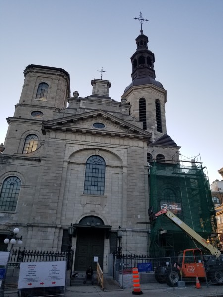
By 1647, the Quebec community of only 355 people had its first stone church, Notre-Dame de la Paix, which became Notre-Dame de Québec in 1664 and a Cathedral in 1674. It’s had to be completely rebuilt twice since then, once after the English bombarded and burned it in 1759 and again after a fire destroyed it in 1922.4
I tried to get a good photo of today’s version, but the structure was too big and too many buildings blocked my long range view. I wanted the photo to include in a story about my ancestors Catherine Clarice and Jacques Lussier. The couple got married in Notre-Dame de Québec with nine other couples on October 12, 1671. The first parish priest of Quebec, Henri de Bernieres, officiated. Toussaint Dubeau, Louis Denis dit Lafontaine and Rene Dumas witnessed the wedding.
The marriage was a second one for the groom, whose previous wife Charlotte Lamarqe died earlier the same year sometime after the baptism of her daughter Marie in February.5
As I walked around the church looking for a decent shot, I imagined my ancestors’ wedding party coming out of the front doors and having rice tossed at them by guests. The roads around the building would have been dirt then, and most of the buildings now hemming the church in didn’t exist. Despite my struggles to get the imagery right, it was pretty cool imagining their special day late in the autumn.
Multiple Battles, 1700s
At the end of my first day in Quebec City, I found myself in the Quebec General Hospital Cemetery taking photos.
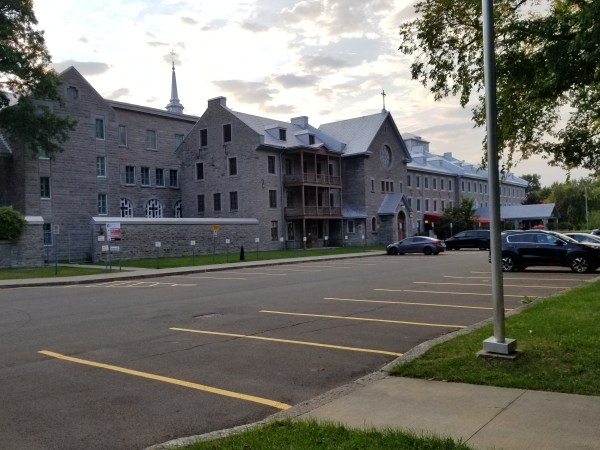
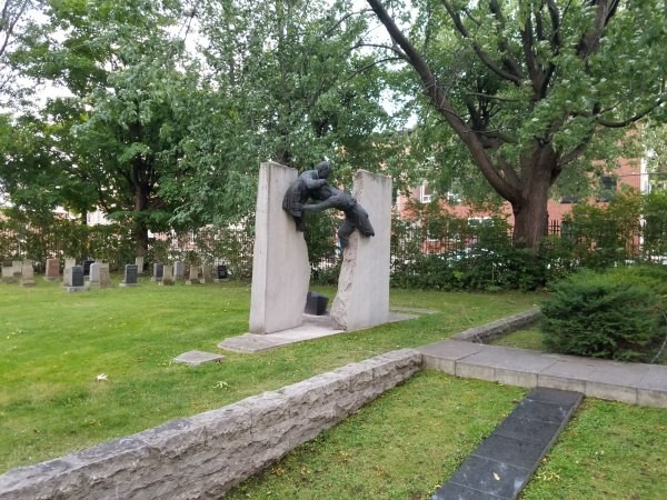
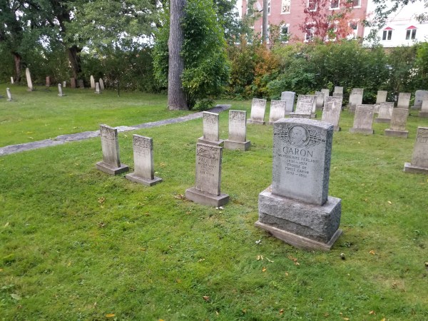
The remains of more than 1,000 French, British and First Nations soldiers who fought in the Seven Years War are located here. A plaque on site and a heritage web site explains the details.
During the fateful battles of the Plains of Abraham and Sainte-Foy in 1759 and 1760, French and British troops fought at Québec’s very doorstep. Since the general hospital was located far from the fighting, it was used to care for the injured from both sides. The Augustinians provided the same assistance to British soldiers as to the French. They also treated Canadian militia and First Nations warriors. However, without access to antiseptics, proper medical procedures, or sufficient staff, the injuries of many combatants proved fatal. The sisters buried the remains of Catholics in a common grave in the parish cemetery, and those of Protestants in another one just next to the cemetery. By 1760 when the fighting ended, 1,058 French, British, and First Nations fighters had been buried at Hôpital général. The Augustinians carefully recorded the name, place of birth, and age of every one of them in the parish register, if that information was known.6
The Seven Years War, a battle between England, France and Spain, lasted from 1756 until 1763, but England and France were fighting over Quebec City as early as 1690.
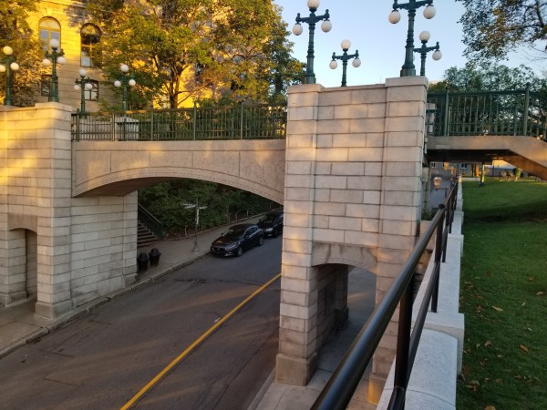
Walls to protect the city were built in the summer of 1690 after Port Royal fell to the British in May. They were in place by October, when the British arrived and the first Battle of Quebec began. In 1693, the French built the Cap Diamant Redoubt, a protective structure that could have prevented the loss of the City by the French during the Battle of the Plains of Abraham in September 1759. It helped the British protect against seiges by the French in 1760 and the Americans in 1775 and remains an integral part of the Québec Citadel that the British built as a temporary structure in 1789 and then replaced with stone in 1832.
My ancestors Louise Thérèse Lareau and Joseph Beleau dit Larose lived in Quebec City during both of these sieges, first with their parents and then as a newly married couple for the second one. I decided to walk in their footsteps along Cote St. Abraham Road, which travels along the Sainte-Geneviève hillside cliff and links the St. Charles valley with upper town. This is one of the few routes that didn’t include the many fortifications Quebec City has become known for. During their time, between 1774 and 1795, the street was known as Rue St. Georges. Like them, I walked along the edge of the Heights of Abraham, named after boat pilot Abraham Martin “the Scot” (1589-1664) who received 12 acres in what is now known as the Saint-Jean-Baptiste district from the Company of New France in 1635 and another 20 acres as a gift from Navy Surgeon le Sieur Adrien Du Chesne ten years later. It’s said that the road follows the original trail Martin used to bring his cows to drink in the St. Charles River.
While walking, I decided to set aside the modern wars the City faced, and instead consider geology. Quebec City is unusual in that allows you to investigate three diverse geological periods in one location: the Canadian Shield, the St. Lawrence Lowlands and the Appalachian Mountains. Upper Town and the Plains of Abraham along with Lévis and Ile d’Orléans are part of the Quebec promontory, which glaciers moved north from the rest of the Appalachian Mountains, which can be seen in the south. Meanwhile, the cliff between Lower Town and Upper Town forms part of the Laurentian Mountains, which make up youngest part of the Great Canadian Shield. The cliff itself demonstrates Logan Fault, and gave me a chance to imagine the work of plate tectonics while overlooking the vast Saint Lawrence Lowlands, once covered entirely by the glacial Champlain Sea.
Then I walked up the stairs to get to the earliest suburb outside the City Walls.
The first Fauberg of Quebec: St. Roche Parish 1829
Looking at my notes, I noticed that three of my ancestors lived in the St. Roche Parish. Programming the map finder on my phone to include stop-offs along the walking route, I set off. It took about 15 minutes to walk along Saint Vallier Street. I began looking for number 28, the place where Joseph Belleau and Marie-Anne Ratté lived in 1832.
As I walked, I tried to imagine the internationally-prominent city J Brouchette described that very year.
Québec is also the most important seaport of British America, excepting probably Halifax. Its harbour, situated upwards of 400 miles from the sea in the gulf, is perfectly safe and calculated to receive the largest fleet.7
Today, we call the district through which I walked Saint Roch after the first village set up beyond the walled city of Quebec City in 1829. Tucked between the cliff to Upper Town and the Saint-Charles River, Saint Roch Village housed many working class people, many of whom kept 20 different shipyards active. As a baker8, Joseph probably got lots of work feeding labourers drawn to the area.
I got more hints about how my ancestors might have lived from a wonderful essay by W. H. Parker about life in Quebec in the 1830’s. One paragraph describes Saint Roche.
A third part of the town, distinct from the basse-ville and haute-ville, was the suburb of St. Roch, which had developed between the river St. Charles and the northern side of the Québec platform. It was an industrial district and growing rapidly,9 with accommodation “suited only to the lower ranks”.10
Eventually, I found two lots where Joseph and Marie-Anne may have lived; one to the east of Charest Boulevard Ouest; the other to the west.
The eastern lot sat right across from my lodgings. Today, the space is just an empty lot, but in my head, it contained a tiny house, a bakery and tons of people. For the next two days, I was giddy wondering how this couple with eight children survived. Marie-Anne and Joseph were among 30,000 people who lived in Quebec City in the mid-1800s. Keeping everyone fed, clothed and clean must have been a challenge. How did they feel as they walked up this same street for the first time? What was the weather like? What did they wear? What were their dreams? Confirmation, church register and marriage records display their Catholic heritage, but beyond that, little remains demonstrating their lifestyles.
A wonderful book called “La Vie Quotidienne au Québec” inspired my imagination. The photos reminded me how difficult basic survival was for my ancestors. Their tools took up more space than ours do today, and were difficult to operate. One chapter showed photos of people constructing an oven to bake bread out of sticks, rocks and rope and then covering it with flat boards built to create a peaked roof.11 Did my ancestor bake his bread using such a structure? How big would it have been? Where would he build it? How would he gather the wood needed to make it continually operational in a busy city far from the forest?
Going back to W. H. Parkers’ essay, I learned about the horrible sanitation and garbage issues my ancestors faced, particularly in the spring.
After the melting of the snow in April and May, several streets in the flat suburb of St. Roch are no better than slough; and very offensive sloughs too, from the accumulation of filth that was hidden by the snow in winter. Such places, when acted on by the summer’s sun, must give out very noxious effluvia.12
Luckily, sanitation issues have been long corrected, but they must have made life pretty difficult in their time.
My imagination really got going after reading Parker’s description of the daily food market in Saint Roche in the 1830s.
The crowds of carters, with their wives and families, bringing in the productions of the surrounding country, their brawlings and vociférations in bad French and broken English, from a scène of noise and confusion, amid which appear a few Indian squaws, and the gentlemen of the city and garrison going round to make purchase. Every kind of provision is abundant and cheap, except fish.13
I couldn’t help wondering if Marie-Anne, Joseph or their daughter Judith/Julie brought his bread to sell at the market, something I can well imagine since I run farmers markets today. Certainly their tasks were significantly more time-consuming and difficult than my modern ones are. Still, it’s a link across the ages, and it came from just thinking about an empty lot.
- 1Moussette, M.. “Intendant’s Palace Archaeological Site.” The Canadian Encyclopedia. Historica Canada. Article published November 06, 2008; Last Edited July 08, 2014, http://www.thecanadianencyclopedia.ca/en/article/intendants-palace-archaeological-site. Accessed 25 April 2022.
2Shoaltz, Adam. A History of Canada in Ten Maps, Penguin Canada, Toronto, 2017, p 82.
3Roy, Pierre-Georges, The old churches of the province of Quebec […], Québec, King’s Printer, 1925, 1 Ressource en ligne (viii, 323 p.) : ill., Collections de BAnQ. https://numerique.banq.qc.ca/patrimoine/details/52327/2873820.
4https://www.ville.quebec.qc.ca/en/citoyens/patrimoine/quartiers/vieux_quebec/interet/basilique_cathedrale_notre_dame_de_quebec.aspx#, accessed 2022-04-24.
5Quebec, Vital and Church Records (Drouin Collection), 1621-1997 – Drouin IGD
6Ville de Québec – The Hôpital-Général de Québec Cemetery.” Accessed May 11, 2022. https://www.ville.quebec.qc.ca/en/citoyens/patrimoine/quartiers/saint_roch/interet/cimetiere_de_l_hopital_general_de_quebec.aspx.
7BOUCHETTE, J., A topographical dictionary of the province of Lower Canada (London, 1832), under Quebec as quoted by W. H. Parker, “Québec City in the 1830’s.” Cahiers de Géographie Du Québec 3, no. 6 (1959): 261. https://doi.org/10.7202/020184ar.
8Archives de la paroisse de Notre-Dame-de-Québec, CM1/F1, 3, vol. 4, p. 36. Visite générale de la paroisse de Québec commencée le 1er octobre 1805, p 36.
9Bouchette, J. The British Dominions in North America (London, 1831), i, p259.
10Willis, Canadian scenery, London, c. 1840, as quoted by W. H. Parker, “Québec City in the 1830’s.” Cahiers de Géographie Du Québec 3, no. 6 (1959): 267.
11Séguin, R. L., R. Bouchard, and Société québécoise des ethnologues. La Vie Quotidienne Au Québec: Histoire, Métiers, Techniques et Traditions : Mélanges à La Mémoire de Robert-Lionel Séguin. Presses de l’Université du Québec, 1983. https://books.google.ca/books?id=RfIUAAAAYAAJ, p355
12Kelly, W., Médical statistics of Lower Canada, 1837, in Transactions of the literary and Historical Society of Québec (Québec, 1837), iii, pp. 210-211.
13Willis, Op Cit, p 11.


Interesting story.
My great great grandfather’s brother Matthew Moodie (born in Scotland) was an import/export merchant in Quebec City from about 1841 till he died in 1874 at 3 Hamel St. near the Quebec Seminary and the Augustine Monastery. Like you, my husband and I visited Que. City a few years ago to “walk in his footsteps”. It was certainly a journey through time. It’s a beautiful city.
Lucinda Potter, Oka, Quebec
LikeLike
Wonderful story and photos, Tracey! I really enjoyed it.
LikeLike