Tag Archives: cemeteries

Seigneuries of the Richelieu River Valley

The PDF research guide linked below explores the seigneuries of the Richelieu River Valley, south-east of Montreal. This compilation includes the seigneuries, cemeteries and notaries of the area, including present-day Chambly, Iberville, Napierville, Longueuil, Lacolle, St. Hyacinthe, Yamaska, La Prairie and Sorel.

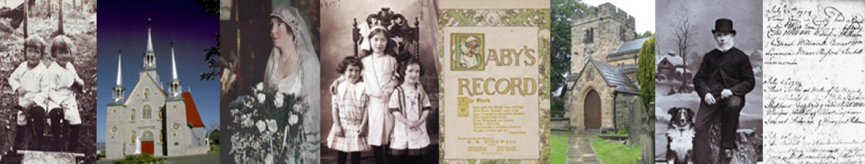
This region was established by officers and soldiers of the Carignan-Salières regiment. French Canadian, Acadian, Loyalist, British, non-Loyalist American, Scottish, Irish, Germanic and Dutch families were present in the Richelieu River Valley from about 1636 to 1899.

After the British Conquest of New France and the American Revolution, large numbers of Loyalists sailed north in Lake Champlain and along the Richelieu River to settle in Missisquoi Bay, the Upper Richelieu near the Vermont-New York State border, St. Johns (St-Jean-sur-Richelieu), Chambly, Sorel and Saint-Ours. They also crossed the St. Lawrence River from Sorel and put down roots in Machiche (Yamachiche), Louiseville, Saint-Cuthbert, Maskinongé and Trois-Rivières.

Between 1669 and 1899, many notaries established careers in the Richelieu River Valley. They recorded land transactions and rental agreements, wills, marriage contracts, protests and other legal documents for the residents. As of 2018, about 70 percent of the notarial records made in this region can be found online, either on the Bibliotheque et Archives nationales du Quebec site (BAnQ.qc.ca), Ancestry.com with two online databases (1647-1942 & 1637-1935), Genealogy Quebec (Drouin Institute), or FamilySearch.org.

On the last page of the attached research guide, I have listed research assistance services offered by BAnQ Montréal under the heading BAnQ Ask a question. If you fill out the detailed questionnaire in English, you should receive a reply in English within 48 hours. Downloads of Notarial Acts at the BAnQ are free.

Here is the link to this PDF: Seigneuries of the Richelieu River Valley

This research guide includes:

p. 1 Introduction to the area and the Carignan-Salières regiment

p. 1. Seigneurs of the area

p. 3. The seigneuries including Beloeil, Carignan, Chambly, Lacolle, Longueil, St. Hyacinthe, Yamaska, La Prairie, Sorel.

p. 23 Regional cemeteries in Chambly, Iberville, Napierville, Monteregie, St. Hyacinthe, St. Jean-sur-Richelieu, Yamaska

p. 24. The notaries: the locations and years they practiced, from 1669 to 1957.

p. 80. Links to archives.

The townships of the Eastern Townships and the seigneuries of the Upper Richelieu River Valley

Today, Quebec’s Eastern Townships and Richelieu Valley areas feature fertile farmland and forests, lakes and rivers, wineries, ski hills and cycling trails for tourists, but at the end of the 18th and beginning of the 19th centuries, these areas were being newly settled by former colonial soldiers, British families, new immigrants from Scotland and Ireland, and Loyalists from south of the border.

This extensive guide to the settlement of these areas includes a description of the counties and townships in southern Quebec where these people settled. It does not attempt to cover any of the First Nations people who lived here before the European settlers arrived.

Quebec’s Eastern Townships and the Upper Richelieu Valley

Here are the topics you will find in this 120-page PDF:

Page 1   Biographies of the governors, land surveyors, missionaries and seigneurs who were influential in this area. Also geographical information about the Eastern Townships and a map of the area in 1792.

Page 6   An alphabetical list of the townships and counties of southern Quebec, with a brief history of the settlement of each area. Places highlighted in the Eastern Townships include Acton, Barford, Brome County, Bury, Compton, Drummondville, Magog, Megantic County, Missisquoi County, Richmond, Sherbrooke, Sutton, Stanstead and Thetford Township. The list of places in the Upper Richelieu Valley begins on p. 68 and includes Lacolle, and Saint-Valentin.  Where place names or jurisdiction have changed, I have indicated the old and new information. I have included links to a variety of web pages including archival sites, cemetery lists, and information about area churches.

Page 72   A list of links to cemeteries in these areas.

Page 75   A list of judicial districts and information on some of the notaries who worked in these communities. This section includes links to the more detailed articles I have written and published on Genealogy Ensemble about important notaries in these areas such as Louis Chaboillez and Peter Lukin.

Page 109   A list of repositories, including branches of the BAnQ, Bishops University and Protestant church archives.

Page 114   Links to some of my own articles on topics such as the saddlebag preachers and the German presence in the Eastern Townships.

Page 115   A list of authors, historians, genealogists and archivists who have contributed to our understanding of the history and people of the Eastern Townships.

Most people do not combine the Eastern Townships (better known in Quebec as les Cantons de l’Est, or l’Estrie,) with the Upper Richelieu River Valley. The Richelieu River lies to the west of the Eastern Townships and connects Lake Champlain to the St. Lawrence River. I did so because, following the British Conquest of 1759 at the Plains of Abraham, British officers, British and Scottish soldiers, and Loyalist families fleeing the United States after the American Revolution began to emigrate to the shores of the Richelieu River.

They settled along the length of the Richelieu, from the fortified town of Sorel on the St. Lawrence River to the village of Lacolle at the U.S. border, populating towns such as Chambly, St. Johns (also referred to as Dorchester in the 1780s and later renamed Saint-Jean-sur-Richelieu, the original name under French rule), Abbotsford, McMasterville, Otterburn Park, Mount Johnson (Mont-St-Grégoire), the Seigneury of Sir John Johnson, the Seigneury of Gabriel Christie, Henryville, Christieville, Odelltown, Clarenceville, Noyan, Fadden Corner and hamlets along the western sector of Missisquoi Bay.

One reason people chose to live in these areas was that much of the land in Quebec was owned by a few landowners called seigneurs. This system of land ownership, based on feudal principles borrowed from France, continued until the middle of the 19th century. The  Loyalists especially, who had owned their own land in the Thirteen Colonies, did not wish to settle on seigneurial lands and pay a rent yearly to a seigneur whom they had never met. So Governor Frederick Haldimand decided to create the Eastern Townships of Quebec and Governor Guy Carleton (Lord Dorchester) who replaced Haldimand (second term as governor) supported Haldimand’s decision.